New York – The GPS industry and Lightsquared, which plans a satellite- and terrestrial-based 4G voice and data network, plan to conduct field tests to determine whether Lightsquared’s terrestrial cell sites will, as Garmin believes, interfere with the operation of GPS-equipped consumer products and commercial devices.
Based on lab tests using one of its portable navigation devices (PNDs) and one of its aircraft GPS units, Garmin found that its PND would completely lose GPS satellite signals within 0.66 miles of a cell site when the PND is under an open sky. In urban areas where some GPS satellites’ signals are more likely to be blocked, the PND would lose its position within 1.79 miles of Lightsquared cellsites, which would operate in the 1525MHz to 1559MHz band next the 1559MHZ to 1610MHz GPS band.
Lightsquared plans to build 40,000 cell sites, most of which will be in urban areas where most consumer GPS devices are used, a Garmin spokesman warned. The terrestrial network will cover 92 percent of the U.S. population in 2015 if all goes according to plan.
The effects of base-station jamming on Garmin’s avionic device were greater, with the device losing its location within 5.6 miles of a cell site while in the open sky.
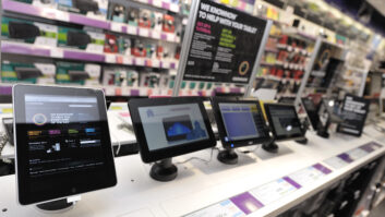
Although Garmin’s PND test involved only one PND model, Garmin said the device was representative of most PNDs and that the PND test likely replicates the interference that other consumer GPS devices would encounter. Those devices would include GPS-equipped cellphones and in-dash navigation systems.
For its part, Lightsquared said it is working cooperatively with the GPS Industry Council to develop test methodology that will use real base stations and multiple GPS devices in real-world situations. But Lightsquared’s Jeff Carlisle, executive VP for regulatory affairs, noted that the base stations were designed with filters endorsed by the GPS Industry Council about eight years ago to prevent out-of-band emissions from entering the GPS band. The filters were developed by Lightsquared’s predecessor company, Mobile Satellite Ventures, which proposed a hybrid satellite-terrestrial network to the FCC, and the filters abide by “stricter out-of-band emission restrictions that those required by the FCC,” Carlisle noted.
Carlisle also contended that Garmin’s lab tests simulated a filter that “allowed significantly more interference to get through” than the filters that will be used in the base stations.
As a result, Carlisle said he suspects “a significant number of GPS receivers are adequately filtered” and won’t suffer interference issues. However, “some subset of receivers are looking into the L band,” he said. Field testing will determine how many GPS receivers are susceptible and will help Lightsquared “know exactly how our transmitters are operating,” he said.
Once the tests determine the types, models and number of devices affected, the next step would be to determine how the affected devices are used and whether users would come close enough to a base station to be affected, Carlisle said. The tests might be able to isolate the susceptible products to a specific GPS chipset, he noted.
The FCC has asked for a final report by June 15.
For his part, the Garmin spokesman said his company’s lab tests used conservative parameters and noted that the tests simulated full-strength reception of the maximum number of 12 GPS satellites that a navigation device could see at one time.
Although future versions of susceptible navigation devices could be built with additional filtering, Garmin said a filter would not be a “cheap easy fix” and that it’s unclear how existing devices in use could be filtered. The FCC, he noted, wasn’t clear on who would be responsible to fix any problems.
Although Garmin’s test involved only one PND model, Garmin said the device was representative of most PNDs and that the test likely replicates the interference that other consumer GPS devices would encounter. Those devices would include GPS-equipped cellphones and in-dash navigation systems.
The base stations that could create such interference will operate in conjunction with a satellite operating in the same band, enabling the sale of hybrid satellite-terrestrial phones and terrestrial-only phones that deliver IP-based mobile voice and 4G data.
The Federal Communications Commission (FCC) late last year granted a waiver to let Lightsquared build the terrestrial network in the 1525MHz to 1559MHz L-band, which was previously reserved only for satellite service. The FCC, however, made the waiver contingent on Lightsquared and the GPS industry resolving any potential interference problems.
The L-band signals from satellites are faint enough once they hit the ground that they don’t interfere with GPS reception, said a Garmin spokesman, but the high-output signals transmitted from terrestrial base stations will.
Garmin completed its tests in January, and the FCC issued its waiver on Jan. 26. The waiver followed a Nov. 19-Dec. 2 period set by the FCC for interested parties to file comments about the proposed waiver.
The comment period, Magellan said, was short, and the company didn’t have enough time to conduct tests and deliver the result to the FCC until January.
Nonetheless, a spokesman said, “We believe our tests are accurate,” and the results are “alarming” not just for consumers but also for financial companies that use GPS signals to time-stamp transactions and for the commercial aviation industry, although planes have systems to back up GPS.
Although the FCC mandated that the GPS industry and Lightsquared resolve the issue of potential interference, the FCC left it unclear whether Lightsquared or GPS suppliers would be responsible for fixing any interference problems uncovered in the field tests, Garmin said.
Although Lightsquared has indicated that GPS products might need filtering to prevent them from receiving signals outside the GPS band, Garmin said that adding filtering to future products “is not an easy fix.” As for the installed base of GPS units, the spokesman said, “I don’t know how you’d filter those.”
Although many GPS-equipped smartphones also use cell-site triangulation to get a fix, some in-car navigation systems might use dead-reckoning technology as a GPS backup, and that PNDs could incorporate dead reckoning, these technologies are typically accurate only to two or three blocks, which isn’t accurate enough for route guidance while driving.
When it announced a contract last year to build, operate and maintain the base stations, LightSquared said it would provide terrestrial- and satellite-based voice and data service on a wholesale basis to retailers, cable operators, and other companies that want to offer service under their own brand.
The company at the time promised in the second half of 2011 to offer the service in four markets — Baltimore, Denver, Phoenix and Las Vegas — as part of a national rollout that will expand service to at least 100 million people by the end of 2012. By the end of 2013, the company will expand service to 145 million people, and 260 million by the end of 2015, service will be available to 92 percent of the U.S. population by the end of 2015, based on an agreement with the FCC.